Features AckerbauMaps
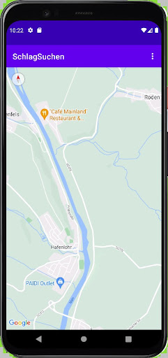
The app is used to search for and save coordinates of self-defined fields in agriculture and forestry.Through a controllable data exchange with the Ackerbau17 app (from 1.7.8), defined and organized fields can be defined therebe assigned to the display of Google maps.A brief overview is available on the "Crop rotation and arable farming" channel.
You can start working in FieldSearch immediately.
A data backup is possible in the app itself, and if desired, canthe coordinates are also transferred to the Ackerbau17 app and stored there.
Gaming Features
Enjoy immersive gaming experience with various game modes.
Shopping Features
Shop online and find the best deals.
Smart Home
Control and monitor your home with smart features.
See the AckerbauMaps in Action
Get the App Today
Available for Android 8.0 and above